Why adopt a trail?
In order to keep our hunt country safe and enjoyable to ride through, we require hunt members to participate in trail maintenance and improvement in the form of five volunteer/work days
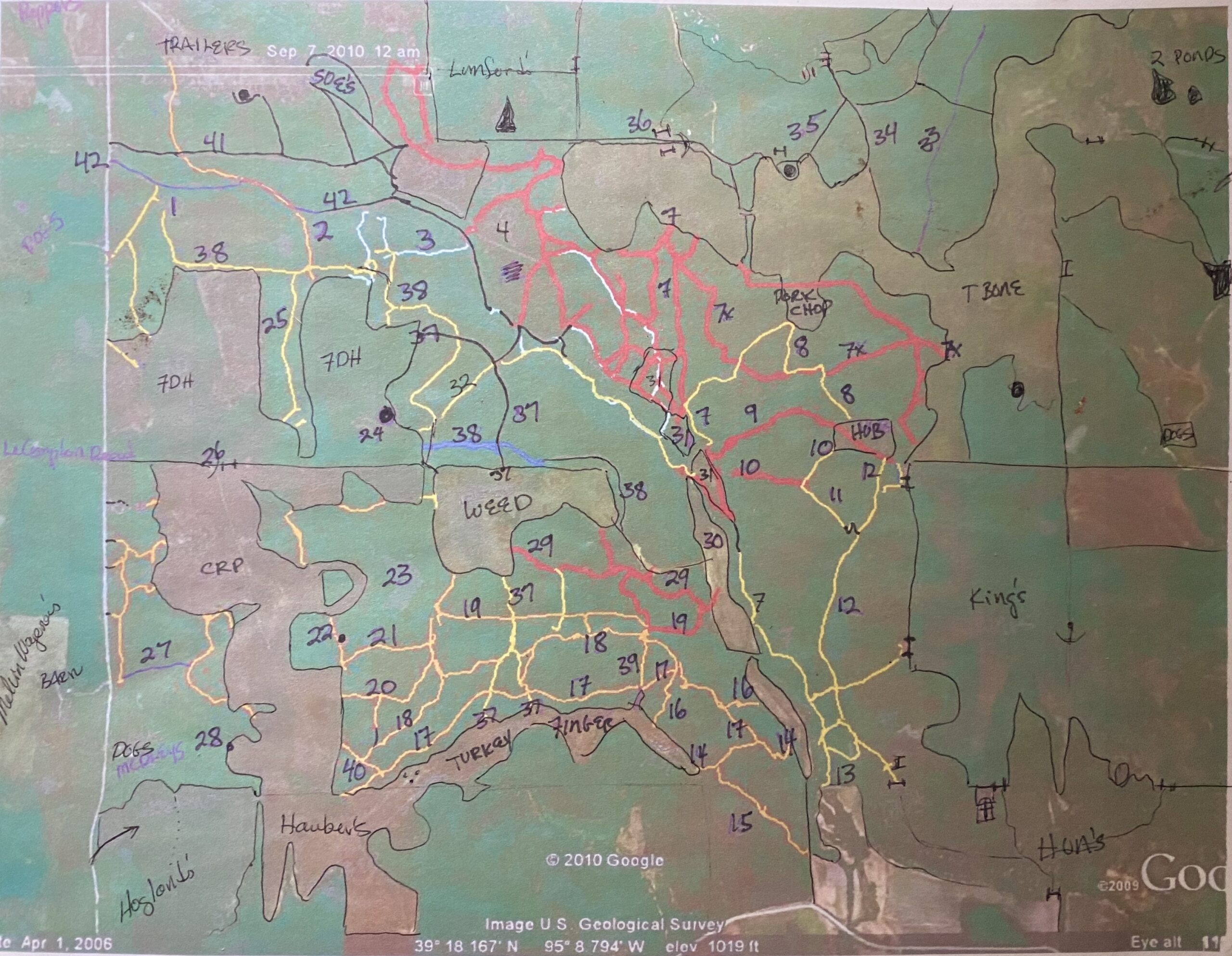
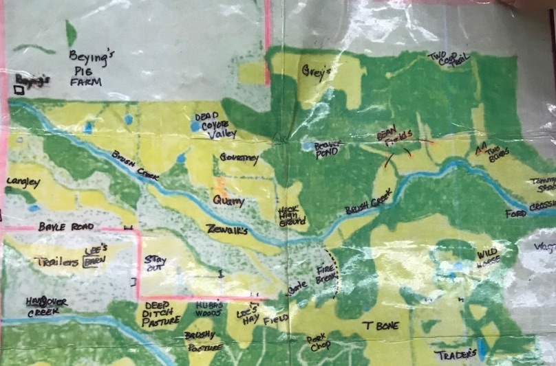
The maps below shows many of the trails in hunt country. (Thank you to Lucy Hirsch for the maps and notations.) The trail names that are greyed out are unavailable/have already been adopted. Please contact Jim Fain or Steve Thomas to adopt a trail.
Adopted Trails
Huntsman’s Trail and extension, Middle Trail – Jill Cook and Chris
Sally’s Trail and Jim’s Trail — Mark French and Bruce McEnroe
North/South Trail — Candy and Steve Smith
Wentzel’s/west of 251st — Jim and Angela Fain
The Longest Road — Steve and Susie Jaster
Trader’s — The Hill Family
Slick Rock Trail – Teresa Griffith and Verona Chaffin
Please note the maps shown below do not cover our entire hunt country, but they should provide orientation/a starting point.
Please contact a master with any questions.

1. Pucker Hill
2. Old Truck Trail
3. Stump Trail
4. Brushy Pasture
5. Huba’s Woods
6. Zewalk’s Gate
7. Huntsman’s Trail
7x. Extension
8. Thoroughfare
9–11. West/East-West/Middle East
12. Middle Trail
13. Walnut Trail
14. Sally’s Trail
15. Jim’s Trail
16. Mel’s Bells
17. Ferdinand’s Freeway
18. Tick Trail
19. Hodge’s Road
20/21. Hodge’s Trail/Cat Brier
22. Secret Pond
23. Hodge’s Pond
24. Fallen Down House
25. FDH Draw
26. Arapaho Jump
27. Sneak Out
28. Marina
29. Slick Rock Trail
30. Little Green Valley
31. Jelly Beans
32. Slant Road
33. North-South Trail
34. Fire Break
35. Diagonal Trail
36. Stile
37. Polar Express
38. Longest Road
39. Food Plot Trail
40. The Point
41. Tom’s Trail
42. Hangover Creek Road

Brush Creek Road
Road to Hecht’s and Contour Trail
The Black Hole
Trails above the Two Barns
Beaver Pond Trails
Three Bears Trails
Wagon Roads
Power Lines
Two Coop Trail
Trader’s
